

Doggerland lost
They broke off after the cold. The ice age was over, the glaciers had retreated all the way back to Scandinavia, and humans wandered Northward. Over the land they settled down on, the North Sea today swashes.
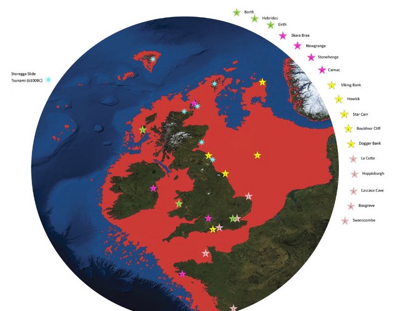
Doggerland (in red): The new atlas shows that the sunken land was considerably larger than had been thought previously. The legend shows the sites of archaeological finds. The blue stars indicate traces of the tsunami which caused large parts of Doggerland to disappear under the sea around 6100 B.C.
The mesolithic paradise
You must imagine the place as a paradise. Lakes lapping gently in the marshes, rivers winding their course through lusch landscapes of grasses and bushes. Food was a-plenty: the waters teemed with fish, birds nested in the reeds, berrybushes covered the banks. Archaeologists surmise that, until about 8,000 years ago, thousands of humans must have lived on what is today the bottom of the North Sea.
Geoscientists have now resurrected their long-gone land. At last year's summer meeting of the British Royal Society in London, they presented an Atlas of Doggerland, the sunken world between Britain and continental Europe of 7,500 years ago.
The land was considerably larger than had been believed and shown in books until now: it spread all the way up to Northern Scotland, from where it connected Denmark with the British Isles, and to the South, one could have walk across the Channel from France to Ireland. In the distance, the steep, abrupt cliffs of today's Britain would have towered into the sky.
But our ancestors would have found the thriving Doggerland much more appealing. "It was the true heart of Europe," says Richard Bates, a geochemist at St Andrews University in Scotland. Hundreds of finds of stone tools, harpoons and human bones are evidence of the history of teeming life on today's North Sea grounds. Pollen deposits in the mud tell us much about the plant life.
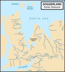
The earlier map of Doggerland
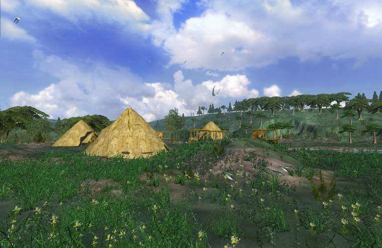
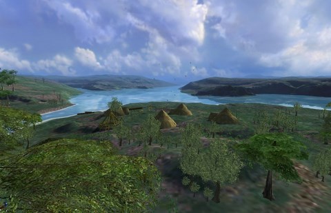
Graphic reconstruction: Eugene Ch'ng and his team of the University of Wolverhampton have reconstituted the aspect of Doggerland in a computer animation.
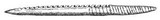
This lost world was first discovered in 1931 when a trawler (the Colinda) was fishing at night 25 miles east of Norfolk near the Owen Bank. Its skipper Pilgrim E. Lockwood, hauled up a lump of peat and broke it open with a spade. Inside was an elegant barbed antler point. Pollen studies of peat dredged from the area indicate that it was covered with woodlands. The age of the barb it turns out was 2,000 years older, indicating that is was lost while Doggerland was a tundra.1)
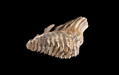
A mammuth bone found at the bottom of the North Sea.
It was knowledge gathered during oil prospection which brought back the outlines of the old landscape. "Only since during these past years we have received the data from the oil companies, have we been able to reconstruct what the lost land looked like," Bates says. Sound-wave measurements of the sea bottom reveal the relief of the former land surface.
During a 15 year research project, scientists have compared the data made available by oil drilling companies with the climatological data and with the archaeological finds: while at the end of the last ice age, glaciers continued to melt, and their melwaters made the sea levels rise, the North Sea closed in on Doggerland ever more.
At first, it swallowed up the swamps and the valleys. "In the end, the settlements on the hill tops found themselves isolated," says Bates. Today, sandbars in the sea are treasure troves for the legacy of the inhabitants of Doggerland.
The end came in a flash: about 8,000 years ago, tsunamis raced through the North Sea. In the sea bottom in front of the coast of Norway, huge masses of mud slid down a 1000 meter slope - an event known as the Storegga Slide - and gave rise to the enormous waves. Traces of the tsunami have been found in Norway, Iceland, on the Shetland Islands and on the Faroe Islands.
The stone age people were taken by surprise. In front of the coast near Inverness, in a place which would have been some ten meters above sea level, "archaeologists have recovered almost 5,000 flint artifacts, bone fragments and a fireplace. On some day close to 7,000BC a small group of Mesolithic hunters were in a natural hollow in the dune. A few hours earlier, the massive sub-marine Storegga landslide occurred 1,000km to the north within the Arctic Ocean between Norway and Iceland. (...) It created a huge tsunami that probably hit their beach with a height of 8m. More than 17,000 cubic kilometers of white, stony sand buried everything as far as could be seen to the north and south. The impact of this tsunami across the low-lying coast of Doggerland must have been devastating. Many km of coastline are likely to have been destroyed within a few hours, perhaps minutes and many lives were lost." 1)
The tsunamis drowned most of Doggerland, according to geologists like David Smith of the University of Oxford. Afterwards, only a small part of the relief would stick out of the waters. 7,500 years ago at the latest, according to the scientists around Richard Bates, Doggerland disappeared in the sea for good.
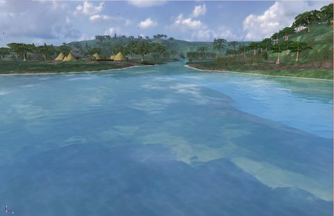
The catastrophic final flooding of Doggerland by the Storegga Slide Tsunami
The catastrophic final flooding of Doggerland by the Storegga Slide tsunami
ABSTRACT – Around 8200 calBP, large parts of the now submerged North Sea continental shelf (‘Doggerland') were catastrophically flooded by the Storegga Slide tsunami, one of the largest tsunamis known for the Holocene, which was generated on the Norwegian coastal margin by a submarine landslide. In the present paper, we derive a precise calendric date for the Storegga Slide tsunami, use this date for reconstruction of contemporary coastlines in the North Sea in relation to rapidly rising sea-levels, and discuss the potential effects of the tsunami on the contemporaneous Mesolithic population. One main result of this study is an unexpectedly high tsunami impact assigned to the western regions of Jutland.
Based on an article by Axel Bojanowski, published in Der Spiegel.
Translated and adapted by Anne-Marie de Grazia
1) W. Patterson - University of Saskatchewan. Coastal Catastrophe, (paleoclimate research document) See here